
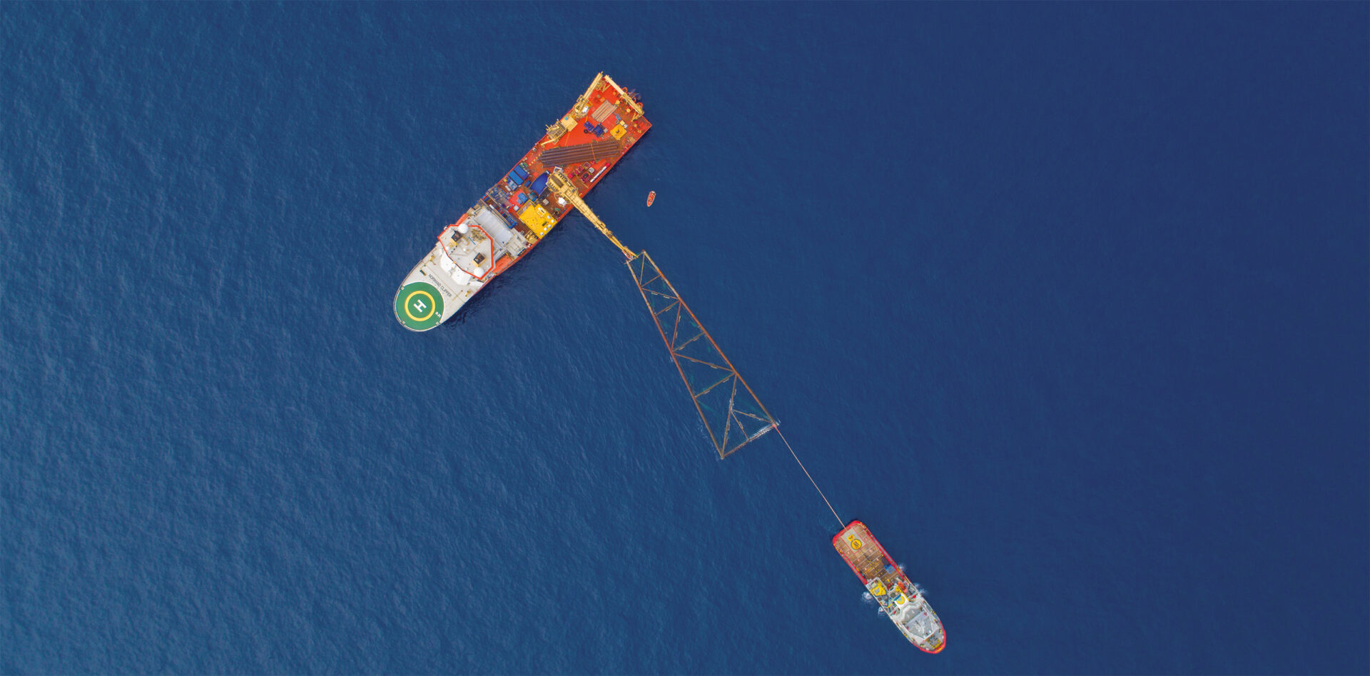
Aerial footage and 3d Inlays (3D animation)
Why not add some exquisite corporate filming to your time-lapse or behind-the-scenes footage? As well as static time-lapse cameras, we can also provide a film crew to document onsite activities. From Drone shoots to professional filming of the main stages of a project, we can help you tell your project’s full story, add in text, graphics, and voice-overs to complete the package.
Prod Space. is here to provide a one-stop solution to all your filming needs. By relying on us for your time-lapse, drone filming, drone photography, and corporate filming, you will have a fantastic record of your project and ultimately save money.
The use of aerial footage and 3D inlays allows us to provide a model of the future state of a project to assure your ability to promote it. We build follow-through drone footage from our aerial construction site and add 3D inlays to create a promotional animated film.
We use state-of-the-art Drones built for hi-resolution aerial video and photography. Our pilots get the shots needed to promote your project using aerial programs.
We also produce high-definition aerial maps acquired through using sophisticated drone-based cameras.
Our innovative technology provides several advantages over classic aircraft. At Prod Space, we go further to get shots from angles previously thought impossible while still capturing 4K images similar to traditional methods.
Using the latest in professional-grade drones, we can collect impactful data and imagery. Our clients can use the data and video we provide for analytical and promotional purposes.
3D Animation
Do you need a 3D model? We will create one for you!
At Prod Space, we bring your business to the next level with skilled and professional aerial 3D renderings. Nowadays, clients expect high-end computer-generated imagery as a standard element of every job:
- Embed your 3D buildings in a real-life environment.
- Visualize your future project in its meant environment
- Use renderings as a marketing tool to promote your projects
- Compare the existing site in its current state with the final project.
At Prod Space, we are shaping the future of the built environment daily alongside industry-leading architects, developers, and builders. Our designers produce top-of-the-line 3D aerial renderings that help you better communicate with stakeholders.
By inserting the 3D model in the shots our cameras have captured (or with 360° aerial panoramas), you can:
- Verify the project’s conformity and measure the overall differences between early ideas, design, and the final product.
- Juxtaposing the current and final stage helps you better understand the construction monitoring photos.
- Show that the builder is doing good work on the construction site and is transparent in showing it.
The trend of intelligent cities design is growing nowadays and with good reason. Technology enhances business productivity and improves the urban environment. Drone-to-3D workflow expedites road construction and maintenance; plan airports, pipelines, and transmission lines; and perform complex maintenance inspections. We support urban planning by rendering accurate cityscapes and transportation models. We also supply a variety of infrastructure projects with detailed, real-world visualizations.
Here is a rundown of the various steps of our process:
- Making 3D models with a drone: Excellent-quality 3D aerial models are obtainable using only a drone and the appropriate apps.
- Combining drone footage with 3D aerial renderings: Our designers can create the final rendering. Flyovers, walkthroughs, fly-through animations, 3D aerial diagrams, and still images are just some of the possibilities to explore.
- Flyovers, 3D walkthroughs, and fly-through animations: We excel in creating accurate, photorealistic 3D walkthroughs and 3D flyover animations that showcase your project’s strengths.
- 3D aerial diagrams: We will overlay crucial information to make 3D aerial diagrams that personalize your message, whether it’s for a simple residential place or a large and complex landscape. You can pick a birds-eye view or a raised-eye view to see your data up close.
- Compositing a 3D model into a pre-existing scene: In addition to aerial perspective, we use several technical tools to deliver compelling 3D aerial visualizations.